Visualizing spatial data one graphic at a time
By Adam Feigl (Posted Aug. 9, 2018):
The SynTerra Graphics Management team works behind the scenes—across applications, platforms and dimensions—to create compelling visual representations.
Graphics come in all shapes and sizes. There are graphics that come in standard letter format that can be reproduced over and over again. There are also graphics that are as large as your average basketball player; it takes four employees who enjoy lifting weights to transfer such ginormous graphics. Some graphics are presented dynamically via PowerPoint or a web-based geographic information system (GIS) program such as Google Earth. Some graphicsare printed on a 3D printer or within a 3D PDF. Overall, the creative processes that can be used to develop a data visualization graphic are infinite, which makes our job awesome!
Who are we anyway? Well, we are the Graphics Management team within SynTerra, and visualizing data via graphics is our passion. We work behind the scenes to provide our clients the best graphics product as efficiently and cost-effectively as possible using myriad software applications. Currently, we specialize in two software applications — Autodesk AutoCAD Civil 3D and ESRI ArcGIS. Our amazing team consists of four AutoCAD specialists and five GIS specialists. Even though they specialize in one application, that doesn’t mean that they are not proficient with the other application. Many members of our team can and have crossed back-and-forth from one application to another (and, in doing so, from one platform to another).
Below is a quick introduction to our Graphics Management team:
AutoCAD Gurus
- John Chastain has more than 30 years’ experience providing AutoCAD services for hydrogeology and natural resource projects. He also is a master at wetland delineation.
- Jeff Coleman has more than 30 years’ experience providing AutoCAD services for civil engineering and landfill design projects. He also uses AutoCAD for our structural and wastewater projects.
- Christina Newell has more than 30 years’ experience providing AutoCAD services for mining and process engineering projects. She also uses MicroStation for our transportation and pulp and paper projects and GIS for our hydrogeology projects.
- Linda Buck has more than 30 years’ experience providing AutoCAD services for utility pipeline, land development, and civil design projects. She also has been an AutoCAD and MicroStation drafting instructor for more than 25 years at both college and corporate levels.
GIS Gurus
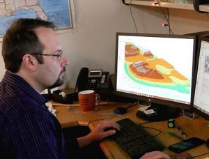
- Adam Feigl (in picture), team leader, has more than 15 years’ experience providing GIS and AutoCAD services for manufacturing, utility, litigation, city planning, and site assessment projects. He also develops hydrogeological cross-sections and three-dimension conceptual site models.
- Antwan Robinson has more than 15 years’ experience providing GIS services for utility pipeline, Phase 1 environmental site assessment, and hydrogeology projects. He also uses AutoCAD and specializes in the area of information technology.
- Kristien King has more than 10 years’ experience providing GIS services for land development, wastewater, and regulatory compliance projects. She also is a Level B Wastewater Operator and former chair of the Greenville County Geographic Information Alliance.
- Ben Young has more than 8 years’ experience providing GIS services for hydrogeology and natural resource projects. He also is a Geographic Information Systems Professional with experience in FEMA floodplain mapping, surveying, and risk analysis.
- Justin Kirtz has more than 8 years’ experience providing GIS services for city planning, regulatory compliance, and land development projects. He specializes in GIS web-application development and coding using Python, JavaScript, and a variety of other programming languages.
Stay tuned for future blog articles showcasing new graphic products and services that we can provide to our clients. With all of the experience listed above, I envision this blog being used as a teaching/learning resource by anyone interested in GIS and CAD topics or just to get a behind-the-scenes look at graphics production. I am very proud of our team members and look forward to working with them on developing new methods, technologies, and products that help our clients visualize their spatial data effectively, efficiently, timely, and creatively.